The Story of the Westman Islands

Last updated: Dec 5th, 2024


Partnering with Time for Geography creating a video series around the case study, we have now enhanced our school geography trips to Iceland to offer the opportunity to visit the incredible Westman islands for further exploration and discoveries. We were inspired by the personal stories of the 1973 Eldfell eruption during our visit to Heimaey in June 2024.

Heimaey is part of the Westman Islands, located off the southern coast of Iceland. The island is surrounded by a stunning volcanic landscape, home to a large population of puffins, and a rich history of natural events. These islands are filled with legends, where the dramatic events of the past meets the breath-taking beauty of the present.

The Dynamic of Iceland’s Volcanic Islands


We’re going back 10,000 to 20,000 years ago where the islands were created by submarine volcanic activity as they sit on the volcanic rift that stretches through Iceland. The islands are still very much in the making, evidenced in 1963 when Surtsey, the newest island, was born from a volcanic eruption originating on the seabed.

The Legend of the Westman Islands (Vestmannaeyjar)


The name Vestmannaeyar , or Westman Islands, comes from two Irish slaves, also known as the “West” men. Both escaped to the islands after a tragic situation with their master, whom was known to be the brother-in-law of Icelands first permanent settler, Ingólfur Arnarson. Seeking justice for the death of Hjörleifur, Ingólfur set out on a journey to find the West men, eventually leading to a dramatic conclusion of fatality. A tale filled with adventure and terrors.

?>

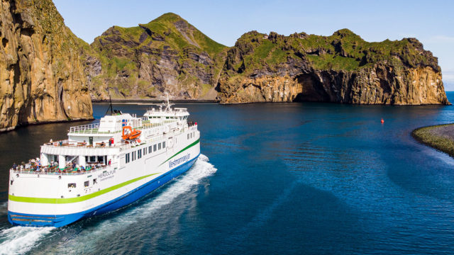
“From the first time I set foot on Vestmannaeyar or the Westman islands I was enthralled. This small group of 15 islands have a magical quality, which starts as you approach by ferry, sailing past soaring cliffs and breathtaking natural beauty.”

Cath Rule, Geography Development Manager

Heimaey: Survival and Change


Heimaey, also known as Home Island, is the largest of the archipelago and the only island that is inhabited, with a population of just over 4000 people. The stunning natural harbour and excellent fishing grounds in the surrounding waters meant that fishing became the backbone of the island’s development. The islanders or “Eyjafólk” are fiercely proud of their unique lifestyle and culture and have a reputation for survival and resilience. Two significant events in the island’s history serve to demonstrate this attribute.

The first was perhaps one of the toughest moments for the island in 1672 when Algerian pirates arrived causing chaos. They pillaged the settlement creating a tragedy by taking the lives of 36 people and capturing 242 men, women and children, who were transported to Algeria. The event is heartbreaking for a small community of 500 people at the time.
The second explosive event took place over 300 hundred years later when, in the early hours of the morning, on 23rd January 1973, a volcanic fissure tore open, on the east side of the island, with little warning. Within 5 hours, the island’s population was evacuated to the mainland with only emergency services remaining behind, with the dangerous responsibility to protect the town and to rescue personal belongings.

Lava, ash and tephra threatened both the settlement and the harbour and rescue workers pumped cold sea water onto the advancing lava flow, to try to divert it away from the harbour. By the time the eruption was declared over on 3rd July 1973, the harbour had been successfully protected but sadly there was one fatality, 400 hundred houses were buried beneath the lava and at least another 650 properties were damage. A thick layer of ash covered the island, a new volcanic cone, Eldfell, had been created and the island had increased in size by more than two square kilometres. Some islanders started to return in the summer of 1973, to a much-changed island, and immediately began the process of recovery. Many others made the difficult decision never to return.
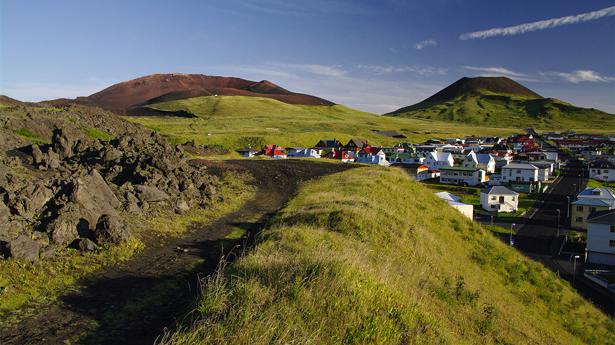
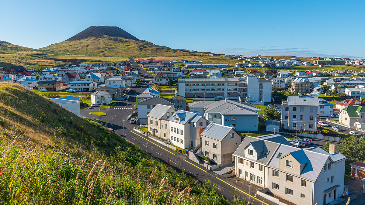
The town of Vestmannaeyjabær with Eldfell in the backdrop, the Westman Islands


The Friendly Town of Vestmannaeyjar


Despite these dramatic setbacks the islanders persevered and today the town of Vestmannaeyjabær is a warm and welcoming place, with picturesque buildings and brightly coloured rooftops. The significant historical events have helped to shape the island’s distinctive culture and landscape and are remembered through commemorative memorials found across the island. During a geography trip to Iceland students can immerse themselves into the culture to gain a deeper understanding of the 1973 Eldfell eruption case study. A town with an eye-opening story that will impact anyone who visits.

Puffins on the Westman Islands


Wildlife in the Westman Islands


The Westman Islands are also home to Europe’s largest Puffin breeding colony. Puffins are closely tied to Heimaey’s history and culture and the islanders have a strong connection to these adorable birds. Spending most of their life at sea, the birds come ashore during the breeding season from late April until early August. Furthermore, Heimaey plays host to a Beluga Whale Sanctuary, where residents Little Whita and Little Gray have found a new home in a large natural bay, having been rescued from a water park in China.

The Westman Islands are an underappreciated corner of Iceland, with much to offer visitors: climb Eldfell volcano, walk the 1973 lavas, visit the Eldheimar Museum, see puffins and whales or explore the coastline by boat. Small enough to be explored in a day but for a true sense of island life why not stay the night.

Cath Rule, Geography Development Manager

Contributor

Cath Rule

Geography Development Manager

Working as a geography teacher across multiple schools in the North West, Cath quickly became an advocate for international school geography trips after witnessing the immense benefits on her students. After nearly two decades in the classroom, she brought all this passion, knowledge and experience to Rayburn Tours, joining the team as Geography Tours Development Manager in 2014.

Today, Cath uses her experience of teaching within a secondary school setting, understanding of the curriculum, and vast knowledge and passion for geography to constantly enhance our geography tours portfolio.

As well as creating an array of free-access teaching resources for use both on-tour and in the classroom, Cath educates our Tour Consultants and Coordinators, and recruits, trains and manages our ever-growing team of geographical Field Study Tutors. And, as if that wasn’t enough, Cath can often be seen out and about with groups sharing her in-depth knowledge as a Field Study Tutor herself!

Discover the Mysteries of Iceland

Filled with hidden secrets and mysteries to discover, explore the west of Iceland as part of your school geography trip and experience new wonders. Take a trip over to the island of Heimaey and watch your case studies come to life with first hand experience of stories from locals and hike solidified lava flows for clues of what lies beneath. Immerse in the great outdoors and plan your next adventure to Iceland!

Discover more

Related Articles

Heimaey Ferry

Discovering the past of Heimaey

Cath Rule, Geography Development Manager for Rayburn Tours, visits Heimaey to discover the impact of the 1973 Eldfell eruption.

My personal story: Heimaey 1973 to 2024

Following the story of the Heimaey 1973 volcanic eruption In January 1973, I was a (very) young Geography teacher at my first school. 1973… this…

Rayburn Tours, Time For Geography and leading universities announce major project

Rayburn Tours and Time for Geography have announced a partnership project centred around Natural Hazards and the Eldfell, Heimaey 1973 volcanic eruption. So much exciting…